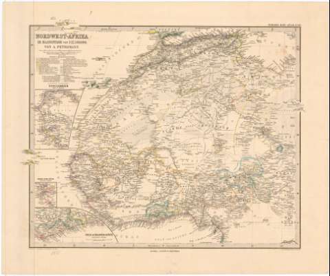
Nordwest-Afrika im Maassstabe von 1:12500000


 Disponible Holdings
 Section: Maps, plans and nautical charts
Uniform title: AFRICA. NO. Mapas generales (1885). 1:12500000
Title: Nordwest-Afrika im Maassstabe von 1:12500000 / Von A. Petermann ; Bearbeitet v. Hanemann & Habenicht ; Gest. v. E.Kuhn, Tewain v. A.Kramer
Material or type of resouce Area: 1:12500000 ; [proyec. ortográfica meridiana] (O 20°20'-E 20°20'/N 35°20'-N 4°30')
Publication: Gotha : Justus Perthes, 1885
Physical description: 1 mapa : col. ; 33,2 x 40,7 cm en h. de 40,5 x 48,8 cm
Content type: Imagen cartográfica
Media type: computadora
Carrier type: recurso en línea
Notes: Coordenadas referidas al meridiano de Hierro (O 15 -E 40 /N 35 20'-N 4 30') y meridiano de París. Red geográfica de 5 en 5
Relieve representado por normales
Relación de las colonias europeas indicadas por clave cromática
Tabla de signos convencionales para indicar fortificaciones, carreteras, arenas, salinas, etc.
Inserta: Senegambien. Escala 1:7500000 ; Sierra Leona. Escala 1:7500000 ; Gold-Sklaven-Kus. Escala 1:7500000
En: Stieler's Hand-Atlas. N. 69
Other authors: Petermann, Augustus Herman
Stieler, Adolf, 1775-1836
Hanemann, A
Kühn, E
Kramer, A
Perthes, Justus, 1749-1816
Habenicht, Hermann
UDC: 912:325.45(6-16)'1885'
6-16
Type of publication:
 Maps
Maps
Rights:
Préstamo:
Disponible
