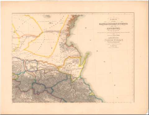
Karte von dem Kaukasischen Isthmus und von Armenien


 Disponible Holdings
 Section: Maps, plans and nautical charts
Uniform title: URSS. SO. Mapas generales (1850). 1:1000000
Title: Karte von dem Kaukasischen Isthmus und von Armenien / Entworfem und gezeichnet nach eigenem Houzontal - Aufnahmen und mit Benutzung der vorhandenen Materialen von Professor Dr. Karl Koch ; H. Mahlmann sc.
Material or type of resouce Area: Escala 1:1000000
Publication: Berlin : Verlag von Dietrich Reimer, 1850
Physical description: 1 mapa : col., montado sobre tela ; 87,5x119,3 cm en h. de 91,9x124,9 cm, pleg. en 91,9x62,5 cm
Content type: Imagen cartográfica
Media type: computadora
Carrier type: recurso en línea
Notes: Escala gráfica ademas en millas geográficas alemanas de posta prusianas, inglesas geográficas etc. Coordenadas referidas a un meridiano que no se especifica (E54°-E68 °/N45°-N38°). Red geográfica de 1° en 1°
Relieve representado por normales
Tabla de signos convencionales para indicar núcleos de población de distinta categoria, fortificaciones, oficinas de postas, etc.
Relacion de los diferentes paises indicados por clave cromática y de los regimientos de ejército indicados por clave alfabética y numérica
Entelado en 32 cuarterones
Materia / lugar / evento: Mapas generales
Divisiones administrativas
1850
Cáucaso
Turquía
Rusia
Other authors: Koch, Karl
Mahlmann, Heinrich
UDC: 912(47-14)'1850'
(496.1+560)
Type of publication:
 Maps
Maps
Rights:
Préstamo:
Disponible
