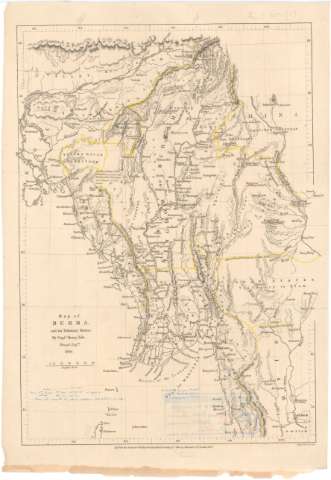
Map of Burma and its Tributary States


Section: Maps, plans and nautical charts
Uniform title: Myanmar. Mapas generales. 1857 (1856). 1:3700000
Title: Map of Burma and its Tributary States / By Captn. Henry Yule
Material or type of resouce Area: Escala [ca. 1:3.700.000], 60 English Miles [= 3'5 cm]
Publication: London : Pubd. for The Journal of The Royal Geographical Society by J. Murray, 1857
Physical description: 1 mapa : col. ; 28'5x20 cm en h. de 32x22 cm
Content type: Imagen cartográfica
Media type: computadora
Carrier type: recurso en línea
Notes: Coordenadas referidas al parecer al meridiano de Londres (E90°50'-E100°30').
Relieve representado por normales
Notas manuscritas al parecer de D. Francisco Coello
Materia / lugar / evento: Mapas generales
1856
Other authors: Yule, Henry
Murray, John
UDC: 912(591)'1856'
591
Type of publication:
 Maps
Maps
Rights:
Préstamo:
 Disponible
