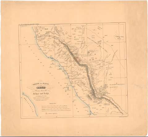
Skizze einer Karte von Asyr und einem Theile von Hedias...
Section: Maps, plans and nautical charts
Uniform title: ARABIA SAUDI. O. Mapas físicos (18). 3:4000000
Title: Skizze einer Karte von Asyr und einem Theile von Hedias und Nedid nach Chedufeaus Materialien / entroorfen von den Capt. Ing. Galinier und Ferret..
Material or type of resouce Area: 1:4000000
Publication: [Deutschland] : Umdruck - zeichning b. H. Delius, [18--]
Physical description: 1 mapa : col. ; 43,2 x 48,6 cm en h. de 63,2 x 68,1 cm
Content type: Imagen cartográfica
Media type: computadora
Carrier type: recurso en línea
Notes: En: Zum Atlas von Varder Asien gehórig Helt V Arabien
Escalas gráficas de 12 miriametros, 25 leguas de 25 al grado, 60 millas árabes de 56 1/3 al grado y 25 "Stundennach Kararoanenschritt". Proyec. Mercator. Coordenadas referidas al meridiano de París (E 36°-E 42°15'/N 22°-N 17°). Red geográfica de 1 en 1 grado
Relieve representado por normales
Materia / lugar / evento: Mapas generales
S.XIX
Arabia Saudí
Asia
Other authors: Galinier, Joseph Germain
Delius, Hermann
Ferret, Pierre Victor Adolphe
UDC: 912(532-15)'18'
532-15
Type of publication:
![]() Maps
Maps
Préstamo:
![]() Disponible
Disponible


