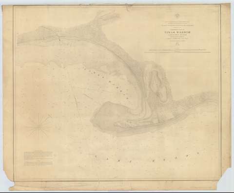
Preliminary Chart of Tawas Harbor [sic] (Harbor [sic] of...


 Maps, plans and nautical charts
Preliminary Chart of Tawas Harbor [sic] (Harbor [sic] of Rejuge Lake Huron) (1857?)
Maps, plans and nautical charts
Preliminary Chart of Tawas Harbor [sic] (Harbor [sic] of Rejuge Lake Huron) (1857?)
 Disponible Holdings
 Section: Maps, plans and nautical charts
Title: Preliminary Chart of Tawas Harbor [sic] (Harbor [sic] of Rejuge Lake Huron) / Surveyed under the direction of Captain J.N. Macomb Topl. Engs. G.W. Lawson, H. Graham, A.C. Lamson 1856 ; made in obedience to acts of congress and under the direction of The Bureau of Topographical Engineers of the War Department
Material or type of resouce Area: Escala 1:16000
Publication: [Washington] : Bureau of Topographical Engineers of the War Department, [1857?]
Physical description: 1 carta náutica ; 61 x 73 cm
Content type: Imagen cartográfica
Media type: computadora
Carrier type: recurso en línea
Series: (Survey of the Northern and North Western Lakes)
Notes: Escala también dada en formas gráficas de 1 milla legal y 1 milla náutica. Orientado con nudo de treintaidos rumbos, en la que señala además la variación magnética observada
Fecha tomada del sello que figura en el documento
Relieve por normales
Indica sondas batimétricas y veriles, así como las distintas líneas de derrota a seguir para arribar a la bahía
En nota se explican las derrotas consejables para navegar por la bahía
Materia / lugar / evento: Cartas náuticas
Batimetría
Bahías
1856
1857
Other authors: Macomb, J. N
Lawson, George William
Graham, H
Lawson, A.G
Estados Unidos. War Department. Engineer Bureau
UDC: 774-11
Type of publication:
Maps
Rights:
Préstamo:
Disponible
