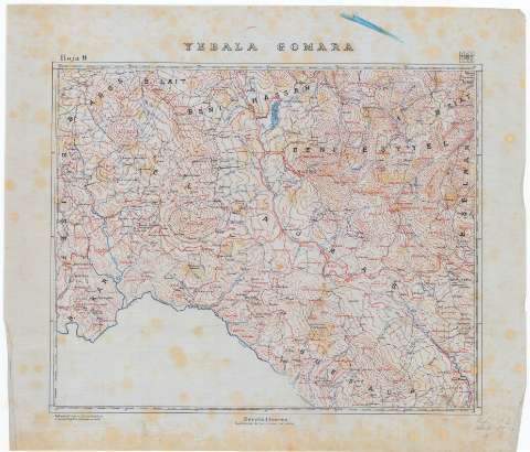
Yebala, Gomara. Hoja 9


Section: Maps, plans and nautical charts
Title: Yebala, Gomara [Material cartográfico]. Hoja 9 / Reducción del mapa en 1:50.000 formado por la Comisión Geográfica de Marruecos y Límites
Material or type of resouce Area: Escala 1:100.000
Publication: [1906?]
Physical description: 1 mapa : ms., col., sobre tela para planos ; 53 x 61 cm
Content type: Imagen cartográfica
Media type: computadora
Carrier type: recurso en línea
Other titles: En: [Mapa del Protectorado Español de Marruecos]
Materia / lugar / evento: Mapas generales
1906
1912-1956
Yebala
Chauen (Región histórica)
Marruecos (Protectorado Español)
UDC: (64 Marruecos, Protectorado Español)
Type of publication:
 Maps
Maps
Rights:
Archivo Cartográfico de Estudios Geográficos del Centro Geográfico del Ejército
Collection: PCGE — Location: DE — Call number: MAR-C.2-026 H.9 — Código de barras: 9778550 — Notes: Bueno
Préstamo:
 Disponible

© Ministerio de Defensa de España
P. de la Castellana, 109 28071 Madrid.
Tlf: (34) 91 395 50 00
Email: patrimonio.cultural@oc.mde.es