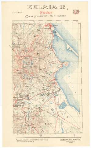
Nador : Kelaia. H. 13-4


 Disponible Holdings
 Section: Maps, plans and nautical charts
Title: Nador : Kelaia. H. 13-4
Edición: 3ª ed.
Material or type of resouce Area: Escala 1:50.000 ; proyec. policéntrica, cuadrícula en cónica secante
Publication: [Madrid] : Talleres del Servicio Geográfico del Ejército, 1958
Physical description: 1 h. : col. ; 56 x 34 cm o menor
Content type: Imagen cartográfica
Media type: computadora
Carrier type: recurso en línea
Notes: En margen superior: Gráfico de localización de la hoja
Levantado por taquimetría
Márgenes superior y derecho graduados. - Mapa en cuadrícula. - Relieve representado por curvas de nivel, equidistancia 20 metros y puntos acotados. - Playas. - Montes. - Minas. - Arbolado, cultivos. - Hidrografía. - Red de carreteras, caminos y ferrocarriles. - Toponimia. - Representación esquemática de ciudades, núcleos urbanos, edificaciones aisladas, zocos, hospital, cementerios, ruinas y santuarios. - Divisiones administrativas
Other titles: En: Marruecos : Mapa provisional en E. 1:50.000. - 3ª ed.. - [Madrid] : Servicio Geográfico del Ejército, 1956-1959. - H. 13-4
Materia / lugar / evento: Marruecos - Historia - 1912-1956 (Protectorado español) - Mapas
Nador (Provincia) - Mapas
Genre / form: Mapas topográficos
UDC: (64 Guelaya)
Type of publication:
 Maps
Maps
Rights:
Préstamo:
Disponible
