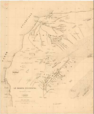
Le Sahara Occidental : D'aprés Trois Pelerins de L'Adrar


 Disponible Holdings
 Section: Maps, plans and nautical charts
Uniform title: Sahara Occidental. Mapas generales (188). 1:1800000
Title: Le Sahara Occidental : D'aprés Trois Pelerins de L'Adrar / par E. Masqueray...
Material or type of resouce Area: Escala [ca. 1:1800000 ; proyec. cilindrica]
Publication: Alger : Imprimerie A Jourdan, [188- ?]
Physical description: 1 mapa : montado sobre tela ; 73x61 cm, pleg. en 36,6x61, 1 cm
Content type: Imagen cartográfica
Media type: computadora
Carrier type: recurso en línea
Notes: Escala hallada a partir de un grado de latitud [= 5,9 cm]. Coordenadas referidas al meridiano de Paris (O19°30'-O9°00'/N29°00'-N18°00'). Red geográfica de 1° en 1°
Materia / lugar / evento: Mapas generales
S.XIX
Other authors: Masqueray, E
Jourdan, Adolphe
UDC: 912(648)'1880/1889'
648
Type of publication:
 Maps
Maps
Rights:
Préstamo:
Disponible
