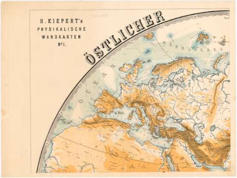
H. Kiepert's Physikalische Wandkarten


Section: Maps, plans and nautical charts
Uniform title: Mundo. Mapas físicos (1878). 1:22000000-1:11000000
Title: H. Kiepert's Physikalische Wandkarten / zeichnung von R. Kiepert ; Lith. Anst. v. Leopold Kraatz
Material or type of resouce Area: Escala [ca. 1:22000000 - ca. 1:11000000 ; proyec. esferoidal]
Publication: Berlin : Verlag von Dietrich Reimer, 1878
Physical description: 1 mapa mundi en 10 h. : col. ; 2 hemisferios, 108 cm diám., h. de 49x65 cm
Content type: Imagen cartográfica
Media type: computadora
Carrier type: recurso en línea
Notes: Escala hallada a partir de un grado de latitud [= 0,13 cm] en el Ecuador, [= 1 cm] en el paralelo 80°. Coordenadas referidas al meridiano de Hierro. Red geográfica de 10° en 10°
Relieve representado por tintas hipsometricas
Indica las corrientes marinas
Contenido incompleto: Ostlicher Planiglob - - Westlicher Planiglob
Materia / lugar / evento: Mapas físicos
1878
Other authors: Kiepert, R
Reimer, Dietrich
Kraatz, Leopold
UDC: 912:911.2(100)'1878'
100
Type of publication:
 Maps
Maps
Rights:
Préstamo:
 Disponible
