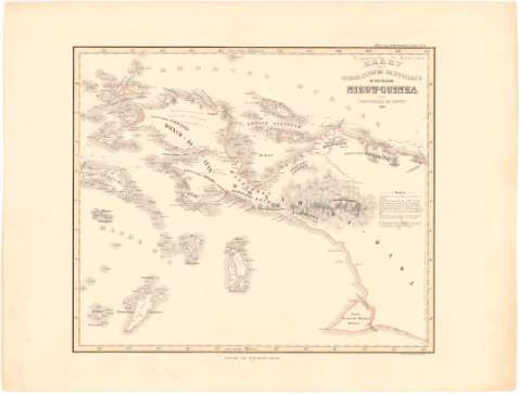
Kaart der Nederlandsche Bezittingen of het Eiland Nieuw -...


 Maps, plans and nautical charts
Kaart der Nederlandsche Bezittingen of het Eiland Nieuw - Guinea (1869)
Maps, plans and nautical charts
Kaart der Nederlandsche Bezittingen of het Eiland Nieuw - Guinea (1869)
 Disponible Holdings
 Section: Maps, plans and nautical charts
Title: Kaart der Nederlandsche Bezittingen of het Eiland Nieuw - Guinea / door P. Baron Melvill van Carnbee ; geteek d. cronenberg en Wolff
Material or type of resouce Area: Escala [ca. 1:4000000] (E129°07'-E141°00'/N0°58'-S8°55')
Publication: [Amsterdam ?] : Nitgave van gualtherus Kolff, 1869
Physical description: 1 mapa : col. ; 38x32,3 cm en h. de 53,7x40,8 cm
Content type: Imagen cartográfica
Media type: computadora
Carrier type: recurso en línea
Notes: Escala hallada a partir de un grado de la latitud [= 3 cm]
Relieve representado por normales
Pertenece al 'Atlas van Nederlandsch Indie. - N°26'
Other authors: Melvill van Carnbee, P Barón
Cronenberg
Kolff, Gualtherus
UDC: 912:551.42(954)'1853-1869'
954
Type of publication:
Maps
Rights:
Préstamo:
Disponible
