The Arafura sea : from the observations of Lieutenants...


 Maps, plans and nautical charts
The Arafura sea : from the observations of Lieutenants Kolff and Moderza of the Dutch navy in 1825-6-8 (1843)
Maps, plans and nautical charts
The Arafura sea : from the observations of Lieutenants Kolff and Moderza of the Dutch navy in 1825-6-8 (1843)
 Disponible Holdings
 Section: Maps, plans and nautical charts
Uniform title: ARAFURA (Mar). Cartas náuticas. 1843 (1825-1843). 1:200000
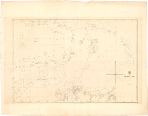
Title: The Arafura sea : from the observations of Lieutenants Kolff and Moderza of the Dutch navy in 1825-6-8 / compiled by George Windsor Earl ; corrected by Captn. O. Stanley R.N. ; J. & C. Walker, Sculpt
Edición: Ed. 1825, corr
Material or type of resouce Area: [Ca. 1:200000] ; [proyec. Mercator] (E 125°00'-E 139°30'/S 3°00'-S 12°42')
Publication: London : Published according to Act of Parliament at the Hydrographic Office of the Admiralty..., 1843 (London : Sold by R.B. Bate Agent for the Sale of the Admiralty Charts 21 Poultri & Royal Exchange East)
Physical description: 1 carta náutica ; 49,5 x 73,2 cm en h. de 67,5 x 84,7 cm
Content type: Imagen cartográfica
Media type: computadora
Carrier type: recurso en línea
Notes: Correcciones en 1843
Escala hallada a partir de un grado de la latitud [= 5,1 cm]. Red geográfica de 1° en 1°. Orientada con estrella y media lis en cuadrante. Nudo de rumbos
Relieve representado por normales
Indica veriles, bajos, fondeaderos y sondas batimétricas en brazas
Materia / lugar / evento: Cartas náuticas
Islas
Mares
S.XIX
Australia
Papúa Nueva Guinea
Asia
Other authors: Windsor Earl, George
Stanley, Owen
J. & C. Walker
UDC: 912:[551.46:551.42](26 Arafura)'1825/1843'
26 Arafura
Type of publication:
Maps
Rights:
Préstamo:
Disponible
