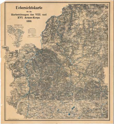
Vebersichtskarte fur die Herbstubungen des VIII und XVI...


 Maps, plans and nautical charts
Vebersichtskarte fur die Herbstubungen des VIII und XVI Armeekorps, 1892 (1892 ?)
Maps, plans and nautical charts
Vebersichtskarte fur die Herbstubungen des VIII und XVI Armeekorps, 1892 (1892 ?)
 Disponible Holdings
 Section: Maps, plans and nautical charts
Uniform title: SARRE (Alemania) (Estado). Mapas generales (1892). 1:200000
Title: Vebersichtskarte fur die Herbstubungen des VIII und XVI Armeekorps, 1892 / Schauenburgs geogr. Anst. Labr
Material or type of resouce Area: Escala 1:200000
Publication: Metz : Selbstuerlag von Registrator Koenings, [1892 ?]
Physical description: 1 mapa : col., montado sobre tela ; 52,4x48,2 cm
Content type: Imagen cartográfica
Media type: computadora
Carrier type: recurso en línea
Notes: Presenta además un plano conjunto
Coloreados en azul los ríos
Relieve representado por normales
Tabla de signos convencionales para indicar caminos, ferrocarriles, carreteras, etc.
Procede de la 'Colección Coello', N 3
Materia / lugar / evento: Mapas generales
Maniobras militares
1892
Lorena
Other authors: Selbstverlag von Registrator Roenigs (Metz)
UDC: 912:355.52(430-328 Sarre)'1892'
(44-328 Lorena)
Type of publication:
Maps
Rights:
Préstamo:
Disponible
