A map of the peninsula of India : from the 19th degree...


 Maps, plans and nautical charts
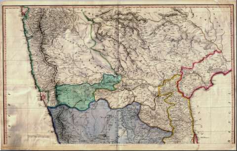
A map of the peninsula of India : from the 19th degree north latitude to Cape Comorin: MDCCXCII (May 1st. 1793)
- Baker, Benjamin
Maps, plans and nautical charts
A map of the peninsula of India : from the 19th degree north latitude to Cape Comorin: MDCCXCII (May 1st. 1793)
- Baker, Benjamin
 Disponible Holdings
 Section: Maps, plans and nautical charts
Title: A map of the peninsula of India : from the 19th degree north latitude to Cape Comorin: MDCCXCII / B. Baker., sculp. Islington
Author: Baker, Benjamin
[A map of the peninsula of India (1792)] All editions
Characteristics of the edition: 1793. 1:1350000. Inglés
Material or type of resouce Area: Escala [ca. 1:1.350.000] (E 72°00'--E 82°00'/N 19°15'--N 7°45')
Publication: London : Printed for W. Faden Geographer, Charing Cross, May 1st. 1793
Physical description: 1 mapa en 2 h. : col. ; 98 x 81 cm, en h. de 52 x 83 cm
Content type: Imagen cartográfica
Media type: computadora
Carrier type: recurso en línea
Notes: Comprende la parte meridional de la península del Indostán
Dedicatoria: "To the king and to the Prince of Wales"
Escalas gráficas de 90 millas británicas [= 10'7 cm], 25 "Sultany Coss", 25 "Royal Coss", 43 "Magully Coss" y 50 "Punjaby Coss". Red geográfica de 1° en 1°
Nota indicando los trabajos que se han tenido en cuenta a la hora de trazar los caminos en el presente mapa
Orografía por normales. Indica sondas batimétricas, veriles y bajos
Relación de las distintas soberanías que se establecieron a raiz de la partición realizada en Seringapatán en 1792, indicadas por clave cromática
Título, notas, escala e impresor enmarcados en cartela
Reproducción digital
Materia / lugar / evento: Divisiones administrativas
Genre / form: Documentos archivísticos
Mapas generales
Other authors: Faden, William, 1749-1836
España. Dirección de Hidrografía, productor. Expediciones a Indias
Museo Naval (Madrid). Archivo. Documentos gráficos, Mapas
Type of publication:
Maps
Rights:
Préstamo:
Disponible
