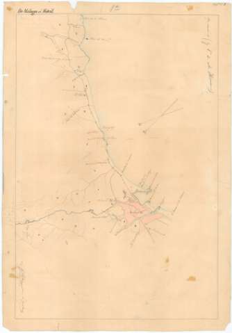
[Itinerario topográfico] De Málaga a Motril


 Disponible Holdings
 Section: Maps, plans and nautical charts
Uniform title: Málaga. Itinerarios topográficos (1848). Español. 1:20.000
Title: [Itinerario topográfico] De Málaga a Motril / [Levantado con la brujula por el Comandante D. Gabriel de Torres, y el Capitan D. Luis de la Torre del Cuerpo de E.M]
Material or type of resouce Area: Escala [1:20000]
Publication: 1848
Physical description: 1 mapa en 3 h. : ms., col. ; en h. de 67,6 x 47,2 cm
Content type: Imagen cartográfica
Media type: computadora
Carrier type: recurso en línea
Notes: Comprende parte de los partidos judiciales de Motril, en la provincia de Granada y Vélez-Málaga en la provincia de Málaga, pasando, entre otras, por las poblaciones de Nerja, Torre del Mar y Almuñécar
Mención de responsabilidad tomados de otro documento que presenta el mismo itinerario
Firmadas y rubricadas por los autores
Orientadas con flecha
Relieve representado por curvas de nivel
Existe una copia en tela para planos
Type of publication:
 Maps
Maps
Rights:
Préstamo:
Disponible
